








Executive Overview
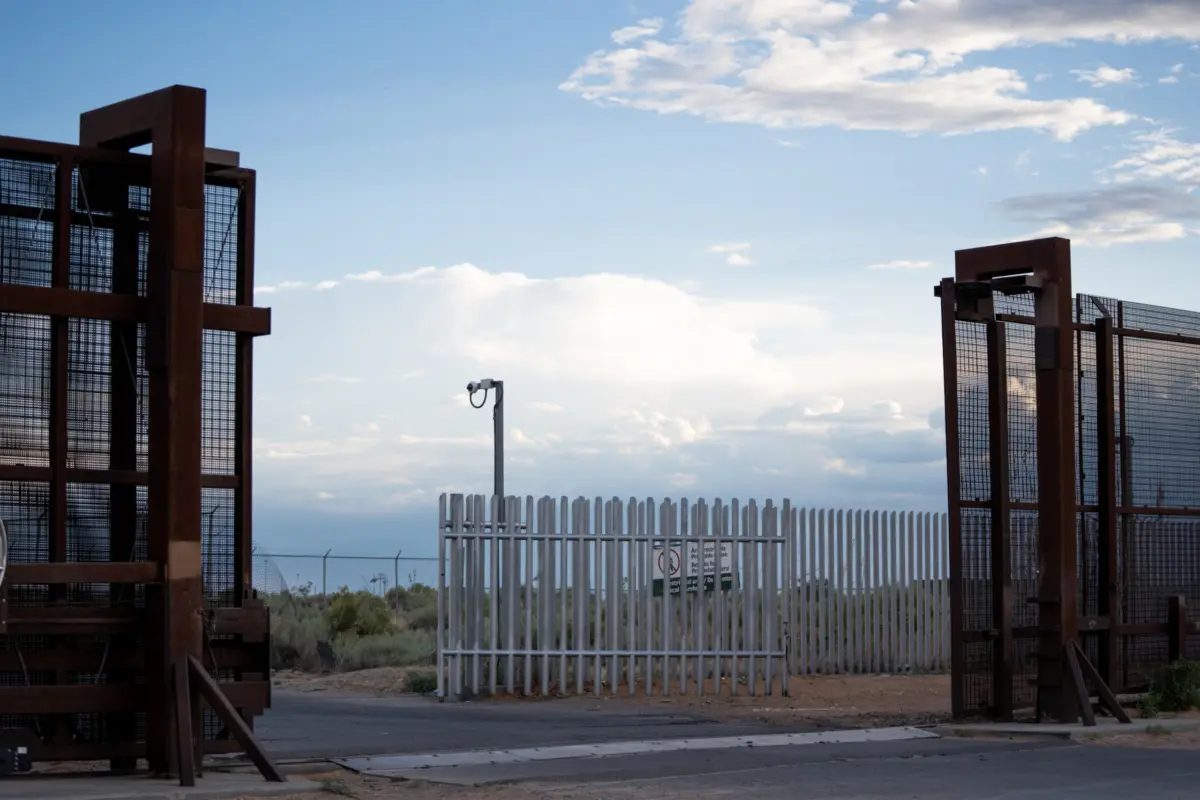
For decades, the United States-Mexico border has stood as one of the most heavily monitored, militarized, and perilous landscapes in the world. In response to mounting geopolitical pressures, successive presidential administrations have poured billions of dollars into high-tech solutions, transforming thousands of square miles of rugged terrain into a sophisticated "virtual wall." Towering steel masts crowned with thermal imaging cameras, radar systems, and autonomous sensors now sweep the horizon, designed to detect unauthorized crossings in real time and direct US Border Patrol agents to individuals in distress or evasion.
Yet, a rigorous 15-month joint investigation by MIT Technology Review and the Times of San Diego—part of the collaborative series Dying on Camera—has uncovered a devastating paradox: thousands of migrants continue to die of dehydration, exposure, and trauma within yards of advanced government surveillance towers meant to track and apprehend them.
Beginning with a fundamental, haunting question—Why did so many people perish near technology supposedly designed to help them?—journalists trawled through thousands of pages of government documents, conducted more than 45 in-depth interviews with key stakeholders (ranging from former White House advisors and presidential appointees to Border Patrol agents, medical examiners, sheriffs, and humanitarian volunteers), and built the first comprehensive, multi-state map and spatial analysis of migrant deaths near border towers.

Analyzing nearly 4,000 cases of human remains discovered between 2015 and mid-2026, researchers matched precise GPS coordinates against historical records of tower installations, tower types, and topographical constraints. The findings illuminate systemic gaps in federal accountability, policy oversight, and data transparency, revealing how technological surveillance has consistently failed to double as a humanitarian lifeline for those navigating the harsh frontier.
Detailed Chronology of the Investigation
The methodology behind this landmark analysis required an exhaustive, multi-year reconstruction of archival records, public records requests, and spatial data. Because no single federal or state database systematically catalogs migrant fatalities alongside infrastructure timelines, reporters had to build the dataset from the ground up, covering a span from 2015 through early 2026 to capture shifting presidential administrations, evolving border policies, and generational leaps in tower technology.
1. Navigating the Data Black Hole in Texas
While states like Arizona have established centralized, publicly accessible data pipelines for migrant remains, Texas presented an immense journalistic roadblock. Texas features no centralized online clearinghouse for migrant deaths; instead, death investigations are handled at the county level by locally elected justices of the peace or county sheriffs.

To capture the most relevant terrain covered by surveillance infrastructure, the investigation targeted 17 Texas counties: Culberson, Jeff Davis, Presidio, Terrell, Val Verde, Kinney, Maverick, Dimmit, Webb, Zapata, Jim Hogg, Starr, Hidalgo, Cameron, Kenedy, Brooks, and Duval.
Beginning in July 2025, reporters filed public records requests with the sheriffs’ offices in these regions. The process was fraught with administrative friction. Requests stalled for months—with some remaining unanswered a year later—and costs ranged from free to exorbitant fees of up to $1,300 per agency. Compounding the issue, local agencies frequently lacked standard checkboxes to designate whether a deceased individual was believed to be a crosser. Consequently, understaffed offices had to pull records manually.
Out of the 17 targeted counties, usable records were ultimately secured from 14. This generated more than 4,000 pages of police reports, some handwritten. To parse high-volume records from Kenedy, Webb, and Hidalgo counties, reporters utilized Anthropic’s Claude via API to extract spatial coordinates of where remains were found, subsequently spot-checking batches manually to ensure accuracy. Ultimately, over 1,500 Texas cases met the strict geographical and temporal criteria for inclusion.

2. Arizona and Multi-State Archives
In Arizona, the investigation leveraged established public health and humanitarian structures. The Pima County Office of the Medical Examiner (PCOME) manages death investigations for all border counties in the state except Yuma. PCOME publishes a regularly updated data portal for migrant fatalities, which is mirrored and mapped by the humanitarian organization Humane Borders. Researchers incorporated data from 2015 through April 2026, filtering strictly for cases with GPS coordinates precise to within 300 feet. This yielded more than 1,700 cases.
For California, New Mexico, Yuma County (Arizona), and El Paso and Hudspeth Counties (Texas), reporters partnered with the nonprofit No More Deaths, which has tracked migrant fatalities since 2004. Incorporating only cases with location precision within a quarter-mile, the team integrated nearly 1,000 additional records from this repository.
Across all sources—after filtering out ambiguous cases, non-border events (such as car crashes during pursuits or deaths inside detention facilities), and unlocatable coordinates—the final analytical database encompassed nearly 4,000 individual cases.

3. Mapping the Virtual Wall: Towers, Types, and Timelines
To evaluate whether a deceased individual fell within the gaze of government surveillance, researchers required three critical data points for every tower: its exact location, its technological type (dictating its advertised visual range), and its precise installation date.
- Location Tracking: Partnering with Dave Maass, Director of Investigations at the Electronic Frontier Foundation (EFF), the team utilized EFF’s comprehensive catalog of Customs and Border Protection (CBP) surveillance towers, which maps roughly 600 of an estimated 800 active federal towers. Using satellite imagery, historical photographs, and Google Street View, reporters verified GPS coordinates for each tower.
- Tower Classifications: The analysis focused on three primary tower types: Integrated Fixed Towers (IFTs), Autonomous Surveillance Towers (ASTs—frequently manufactured by defense tech firm Anduril), and mobile or legacy configurations. Specialized systems stationed at interior checkpoints were excluded due to a lack of clear, uniform operational range data.
- Temporal Validation: Determining when a tower became operational required painstaking temporal analysis of historical satellite imagery. Researchers logged the exact date a tower first materialized in barren desert landscapes—identifying clearings, access roads, and solar panels—and recorded its removal date if applicable.
Supporting Context & Metrics
Matching human remains against surveillance infrastructure required satisfying two rigorous criteria: Distance (the death occurred within the published surveillance range of a nearby camera) and Timing (the tower was physically present when the individual was estimated to have died).
The Spatial and Temporal Calculus
- Distance Analysis: Led by external collaborator Minho Kim (then a postdoctoral researcher at Stanford University specializing in geospatial mapping), software ingested both the human remains database and the tower database, calculating the precise vector between each set of remains and the nearest camera.
- Decomposition and Windows of Death: Establishing when a person died often required translating forensic descriptions of decomposition into temporal windows. Consulting with experts like Dr. Greg Hess of the Pima County Office of the Medical Examiner, researchers reviewed police reports, body photographs, and seasonal decomposition rates. If a body was found as skeletal remains without a specific forensic timeline, a conservative cutoff of six months was applied. Cases where a tower had been present for less than three years prior to the discovery of undated skeletal remains were excluded to mitigate false positives.
- Topographical Viewshed Analysis: A camera’s line of sight can easily be broken by rugged desert topography. To account for this, Kim executed a topographical viewshed analysis. Using a digital elevation model divided into 30-meter (98-foot) grid squares, software drew virtual sightlines between the estimated height of a tower and a standard 5-foot-6-inch human height at the remains’ coordinates. If a ridge or peak obstructed the line, the view was flagged as obstructed. However, because thermal imaging can pierce light vegetation and individuals may have traversed visible zones before succumbing in sheltered depressions, all spatial matches were retained on the map with clear-sight indicators noted where applicable.
Official Statements and Institutional Resistance
Perhaps the most formidable obstacle encountered during the 15-month investigation was the wall of silence erected by federal agencies.

The core human question—Did the United States government watch someone attempt to cross the border, register their presence on a thermal monitor, and fail to dispatch aid, or did the technology miss them entirely?—remains deliberately obscured. CBP does not publicly disclose which automated alerts or video feeds coincided with migrant deaths. Footage is routinely overwritten unless an internal investigation is triggered, which legally occurs only if a migrant dies while actively in federal custody.
Bureaucratic Roadblocks
- Media Access Denied: In September 2025, MIT Technology Review formally requested interviews with current Border Patrol leadership and sought permission to visit the border in Big Bend, Texas, to examine the real-world deployment of Anduril’s autonomous towers. Following nearly a year of administrative delays—compounded by Department of Homeland Security (DHS) funding fluctuations—local approval was briefly granted in July 2026, only to be summarily overruled and denied by DHS headquarters in Washington, D.C.
- Corporate Responses: Prior to publication, detailed technical and operational questions were dispatched to CBP, Anduril Industries, General Dynamics, and Elbit Systems.
- CBP and Anduril issued brief statements acknowledging receipt of inquiries but failed to address substantive operational questions regarding system efficacy or missed alerts.
- General Dynamics referred all queries back to CBP.
- Elbit Systems did not respond.
Future Outlook & Policy Implications
The findings of the Dying on Camera investigation challenge the foundational narrative that technological modernization along the US-Mexico border inherently enhances humanitarian outcomes. For years, proponents of the virtual wall have argued that expanding sensor arrays and artificial intelligence will reduce migrant mortality by allowing agents to locate individuals in remote sectors faster than ever before.
Instead, the data demonstrates a grim reality: thousands of individuals have drawn their last breath within the operational radius of multi-million-dollar surveillance apparatuses. This disconnect points to systemic policy failures that extend far beyond simple engineering limitations:

- Absence of Internal Audits: Federal oversight bodies rarely evaluate whether surveillance towers successfully rescue distressed migrants. Accountability metrics are almost exclusively tethered to apprehension rates and drug interdiction statistics rather than humanitarian preservation of life.
- Data Fragmentation: The opacity of state-level record-keeping—exemplified by Texas’s decentralized county system—shields federal and local agencies from public scrutiny, making independent oversight exceptionally difficult.
- The Human Toll of Deterrence: As border enforcement pushes migrants deeper into hyper-arid, inhospitable wilderness terrains—such as the rugged mountains of West Texas and the scorching dunes of Arizona—reliance on automated sensors without a corresponding mandate for rapid humanitarian intervention risks codifying a system where technology records tragedies rather than preventing them.
As the Department of Homeland Security continues to scale up autonomous tower acquisitions and artificial intelligence analytics along the southern border, this investigation serves as an urgent call for transparency. Without independent federal audits, standardized national protocols for recording borderland deaths, and a binding mandate to deploy surveillance data in the service of life-saving rescue missions, the virtual wall will remain an unfulfilled promise—watching silently as lives slip away in the shadow of progress.