








Executive Overview
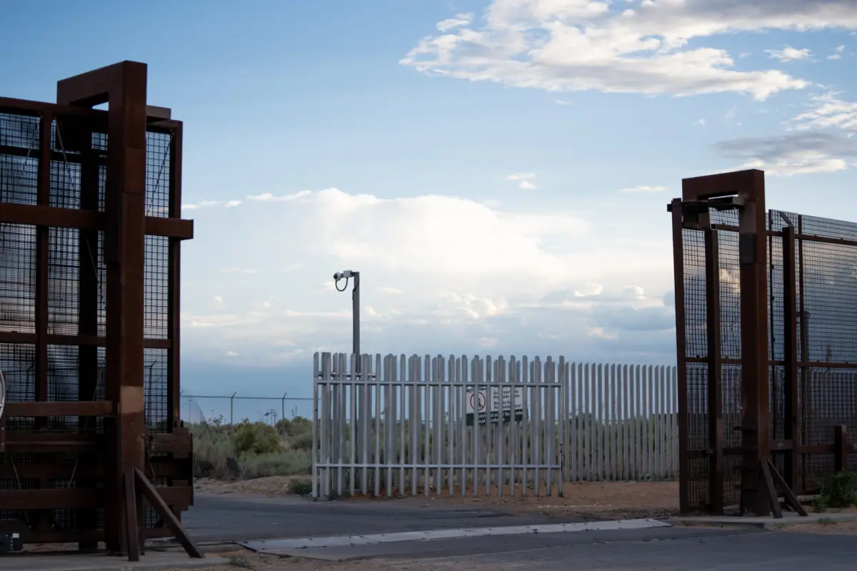
For over two decades, the United States government has fortified the Southern border not just with physical barriers, but with a rapidly expanding "virtual wall"—a high-tech constellation of radar systems, thermal-imaging cameras, and autonomous surveillance towers designed to track, detect, and intercept unauthorized crossings. Yet, this massive technological apparatus exists alongside a grim reality: the US-Mexico border remains the deadliest land crossing in the world.
To understand the alarming convergence of high-tech surveillance and human loss, MIT Technology Review, in collaboration with the Times of San Diego, undertook a rigorous, 15-month investigative project titled Dying on Camera. The investigation began with a haunting, fundamental question: Why do so many people die in close proximity to government surveillance towers specifically meant to help track and apprehend them?
To answer this, journalists conducted an unprecedented data-driven audit. The teams analyzed thousands of pages of government records, conducted dozens of site visits to the borderlands, and interviewed over 45 key stakeholders—including current and former White House advisors, presidential appointees, Border Patrol agents, medical examiners, local sheriffs, humanitarian volunteers, and technology sector employees.
The resulting investigation offers the first comprehensive map and spatial analysis of migrant deaths occurring near border surveillance towers. By synthesizing data spanning from 2015 onward, the project establishes a methodological blueprint for examining how advanced border tech intersects with human vulnerability, casting a critical light on institutional opacity, data gaps, and the systemic blind spots of the virtual wall.

Detailed Chronology and Investigative Methodology
Building a comprehensive database that links migrant fatalities to specific surveillance infrastructure required overcoming immense bureaucratic, geographical, and methodological hurdles. The investigative team structured its data collection around two primary pillars: migrant mortality records and surveillance tower deployments.
Mapping Migrant Deaths: Overcoming Data Deserts
Estimating the death toll of the borderlands is fraught with challenges. While US Customs and Border Protection (CBP) officially estimates that more than 10,000 people have died crossing the border since 2000, researchers widely regard this as an undercount. Remains are frequently never discovered, and there is no unified national protocol for recording or centralizing migrant death data.
To establish a reliable baseline, the investigative team confirmed three criteria for every considered case:
- The individual was believed to be crossing the border.
- The exact location of the remains was documented.
- A reliable timeframe for the death could be established.
The researchers merged established public databases curated by humanitarian groups such as No More Deaths, Humane Borders, and the Electronic Frontier Foundation (EFF) with thousands of fresh records obtained via public records requests across more than a dozen local, state, and federal agencies.

The Texas Challenge
Texas presented the most formidable data desert. Unlike Arizona, which maintains centralized online public health data portals for border deaths, Texas delegates death investigations to individual county authorities.
The reporters identified 17 Texas counties relevant to the investigation based on proximity to surveillance tower coverage: Culberson, Jeff Davis, Presidio, Terrell, Val Verde, Kinney, Maverick, Dimmit, Webb, Zapata, Jim Hogg, Starr, Hidalgo, Cameron, Kenedy, Brooks, and Duval.
In these jurisdictions, locally elected administrative judges—known as justices of the peace—traditionally handle death records. However, these offices often lack standardized record-keeping, with some requests stalling for over a year. Consequently, MIT Technology Review targeted county sheriff offices, which are frequently first on the scene.
Obtaining these files required persistent daily follow-ups, fee negotiations ranging from $300 to $1,300 per county, and managing incomplete archives compromised by misplaced or destroyed paperwork during administrative transitions. Furthermore, because local law enforcement rarely flags cross-border status systematically, researchers had to manually parse more than 4,000 pages of police reports. For voluminous archives from Kenedy, Webb, and Hidalgo counties, the team deployed Anthropic’s Claude API to extract geographic coordinates, subsequently verifying batches by hand. Ultimately, usable records from 14 Texas counties yielded over 1,500 validated cases.

Arizona and Other Border States
In Arizona, the Pima County Office of the Medical Examiner (PCOME) manages border death investigations outside Yuma County, publishing monthly updates via a transparent data portal. Integrating records from PCOME and Humane Borders added over 1,700 cases with precise GPS coordinates accurate to within 300 feet.
For California, New Mexico, Yuma County, and El Paso/Hudspeth counties in Texas, researchers partnered with the nonprofit No More Deaths, filtering nearly 1,000 cases down to those with location precision within a quarter-mile. In total, the project analyzed nearly 4,000 individual cases.
Cataloging the Virtual Wall
Evaluating whether a tower could have registered a person’s final hours required tracking three critical variables: location, tower type, and activation timeline.
- Locations: The team relied on geospatial databases compiled by the Electronic Frontier Foundation (EFF), cross-referencing satellite imagery to verify the precise coordinates of roughly 600 cataloged towers (out of an estimated 800 deployed nationally).
- Tower Types: The analysis focused on three primary surveillance systems: Integrated Fixed Towers (IFTs), Autonomous Surveillance Towers (ASTs)—frequently manufactured by tech firm Anduril—and legacy mobile units. Systems lacking standardized visibility ranges, such as those at internal checkpoints, were excluded.
- Temporal Presence: Using historical satellite imagery, Google Street View, and government filings, researchers painstakingly logged the exact installation date—and removal date, if applicable—for every tower. This ensured that a case was only paired with a tower if the hardware was actively present during the estimated window of death.
Supporting Context & Metrics: The Spatial Analysis
With both datasets established, outside collaborator Minho Kim (a postdoctoral researcher at Stanford University specializing in wildfire and spatial mapping) engineered software to execute a two-part spatial and temporal match:

- Distance: The death had to occur within the published, advertised surveillance range of the nearby tower.
- Timing: The tower must have been physically present and operational during the calculated window of the victim’s passing.
Deconstructing Decomposition and Time-Windows
Because many remains were found skeletal or severely decomposed, determining an exact date of death was impossible. Collaborating with Dr. Greg Hess, director of the Pima County Office of the Medical Examiner, the team established a scientific framework translating environmental exposure, local climate, and bodily decomposition into rough temporal windows.
For skeletal remains lacking specific forensic timelines, researchers applied a conservative three-year cutoff: if a tower had been present for at least three years before remains were discovered, the case was included under the assumption that an undiscovered body would not have predated the infrastructure by an unmeasured margin.
Topographical Viewsheds
A tower’s line of sight can easily be blocked by rugged terrain, dense vegetation, or urban infrastructure. To account for this, the team conducted a topographical viewshed analysis. By mapping regional elevations onto a 30-meter grid, researchers simulated line-of-sight trajectories between tower heights (adjusted for specific hardware specifications) and an assumed human height of 5 feet 6 inches.
While thermal imaging cameras can penetrate light brush and operate effectively in total darkness, terrain ridges and steep canyons frequently create profound visual blind spots. Cases were categorized with visibility flags, though researchers noted that even if a specific death site was obstructed, victims frequently traversed visible corridors prior to their demise.

Official Statements and Institutional Opacity
The core dilemma of the Dying on Camera investigation strikes at the heart of government accountability: Did federal systems detect individuals in distress and fail to dispatch aid, or did the technology fail to register them entirely?
Finding answers through public records proved nearly impossible. US Customs and Border Protection does not publicly disclose automated alerts generated around the time of a migrant death, and sensor footage is routinely purged unless an internal affairs investigation is triggered—a protocol exclusively reserved for deaths occurring directly while individuals are in physical CBP custody.
Requests for formal interviews and site visits submitted by MIT Technology Review to CBP and the Department of Homeland Security (DHS) faced prolonged delays. Although a regional media visit to Big Bend, Texas—an area experiencing an aggressive expansion of Anduril autonomous towers—was initially approved at the local level in July 2026, it was summarily overruled and denied by DHS headquarters in Washington.
When presented with detailed pre-publication findings:

- CBP and Anduril acknowledged receipt of inquiries but declined to address specific substantive questions.
- General Dynamics directed reporters back to CBP.
- Elbit Systems offered no response.
Future Outlook
The integration of artificial intelligence, radar networks, and autonomous sensor towers along the US-Mexico border represents a fundamental paradigm shift in immigration enforcement. Proponents argue that the "virtual wall" optimizes operational efficiency, protects agents from hazardous terrain, and acts as a force multiplier in remote wilderness.
However, the findings of this 15-year historical and spatial analysis expose a profound disconnect between technological deployment and humanitarian outcomes. By mapping thousands of deaths within the operational shadows of multi-million-dollar surveillance infrastructure, this investigation challenges policymakers, technologists, and the public to confront an unsettling reality: the expansion of border surveillance has not halted the rising tide of borderland fatalities.
As the Department of Homeland Security continues to scale up autonomous tower deployments under successive administrations, the imperative for transparency, independent oversight, and rigorous human-rights accountability has never been more urgent. Without internal evaluations measuring how surveillance data translates into life-saving rescue operations, the virtual wall risks remaining an automated witness to ongoing tragedies in the American desert.