







Executive Overview
As the global climate shifts toward hotter, drier extremes, the existential threat of out-of-control wildfires has evolved from a seasonal hazard into a year-round catastrophe. From the historical devastation of Lahaina in Maui to the catastrophic loss of life and property in Los Angeles and the choking, apocalyptic smoke plumes that blanket North America year after year, traditional firefighting mechanisms are increasingly overmatched.
Enter the $11 million XPRIZE Wildfire competition—a high-stakes, multi-year technological gauntlet designed to revolutionize how humanity detects, tracks, and quells raging blazes before they transform into uncontrollable natural disasters.
Concluded in late 2026, the competition’s final tests revealed a stark, sobering reality of modern engineering: while artificial intelligence and aerospace innovation have made the rapid detection of wildfires faster and more precise than ever before, physically stopping a raging fire autonomously remains an extraordinarily elusive challenge. Although cutting-edge solutions from aerospace firms, AI startups, and international consortia successfully met stringent detection timelines across the punishing landscapes of Australia and Alaska, the grand prizes in both major tracks ultimately went unclaimed. The competition proved that while spotting a fire from space or via automated towers is entirely feasible, delivering a decisive, automated knockout blow to a high-risk blaze remains the final frontier in wildfire mitigation.
Detailed Chronology and Testing Grounds
The XPRIZE Wildfire initiative was structured around two distinct tracks, each engineered to address a specific, critical bottleneck in emergency disaster response: early detection and rapid autonomous suppression.
Track 1: Space-Based Wildfire Detection
The first major track challenged international teams to build sophisticated space-based software and AI systems. Their objective was to reliably and accurately detect every single wildfire across a massive geographic sector of Australia within a grueling 10-minute window, minimizing false positives while instantly relaying actionable intelligence to ground crews.
The real-world testing grounds for these orbital systems materialized in April 2026 at the New South Wales Rural Fire Service in Australia. Teams had to leverage existing and emerging satellite constellations—such as OroraTech’s dedicated wildfire-monitoring satellites or Google-backed FireSat microsatellites—to filter out environmental noise and pinpoint active blazes.
While the ultimate $3.5 million grand prize, co-designed and sponsored by the Australia-based Minderoo Foundation, went unclaimed because no single team fulfilled every exhaustive requirement, several standouts were recognized:
- SIRIUS Wildfire Alliance (UK): Secured the $500,000 first-place prize by deploying a comprehensive system that synthesized optical and radar satellite data to identify and model potential fire trajectories.
- Team Snuffed (Arizona): Claimed $250,000 for creating a transparent, auditable, and uncertainty-aware detection pipeline designed for optimal usability by stressed field commanders.
- Special Mentions ($100,000 each): Awarded to MyRadar (Florida), DeepFire (Louisiana), and Mayday.AI (Germany), the latter of which cleverly repurposed a volcanic-ash detection algorithm to spot wildfire smoke through heavy cloud cover.
Track 2: Autonomous Response
If detection is the first hurdle, suppression is the steep precipice. The Autonomous Response track tackled the logistical nightmare of deploying automated suppression assets to a high-risk fire in a remote environment within 10 minutes of ignition, all while ignoring decoy fires.
In June 2026, finalists packed their gear for the harsh, sparsely developed expanses of Nenana, Alaska, near Fairbanks. Spanning a sprawling 386-square-mile test zone—roughly the land area of the San Francisco Bay Area or San Antonio, Texas—teams deployed ground sensors and aerial scout drones to locate a hidden, high-risk fire.
While all three finalists successfully detected the targeted fire in under 10 minutes, and two deployed autonomous drones to attack the blaze, none managed to achieve total extinguishment. Consequently, the grand prize for this track was also withheld, though substantial milestone prizes were distributed:
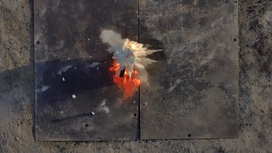
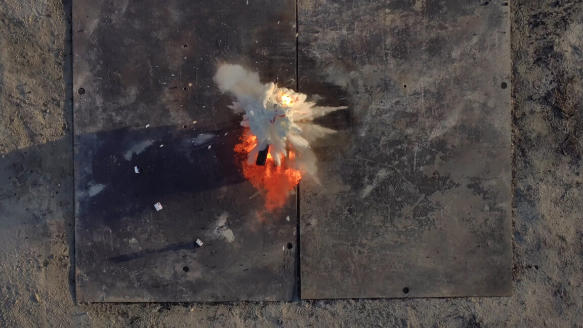
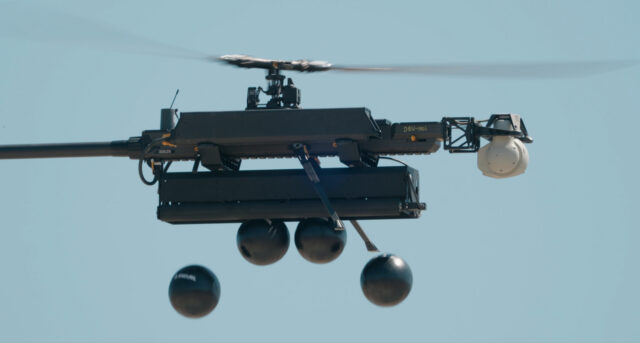
- Anduril Industries (USA): Captured the $1.2 million first-place prize by deploying a Sentry Tower equipped with thermal imaging and AI computer vision. Upon identifying an ignition, Anduril deployed an aerial surveillance swarm followed by its Ghost-X autonomous drone, which dropped specialized "fire retardant balls" directly onto the flames. Anduril also swept an additional $1 million speed-detection bonus prize courtesy of Lockheed Martin.
- Dryad Networks (Germany): Secured $800,000 by establishing a network of 170 solar-powered ground sensors capable of sniffing out trace gases from smoldering wood, which queued up an observation drone for geolocating and a Silvaguard Suppression Drone for the attack run.
- AURA Foresight (UK/Australia Alliance): Earned $500,000 for their ingenious "Home Depot approach," utilizing cheap off-the-shelf DJI drones combined with custom AI software to swarm the target area under extreme preparation constraints.
Supporting Context & Metrics: The Escalating Costs of Wildfire Disasters
The urgency of the XPRIZE Wildfire competition cannot be overstated. Natural disaster metrics compiled over the past several years paint a terrifying picture of climate-driven escalation.
- The Lahaina Catastrophe (August 2023): Sparked by hurricane-force winds, a fast-moving grass fire consumed the historic Hawaiian town of Maui, resulting in at least 102 deaths and signaling how vulnerable coastal and island communities have become.
- The Canadian Smoke Plumes (Summer 2023): Canada endured its most destructive wildfire season in recorded history. Toxic smoke plumes drifted south, turning the skies of major U.S. metropolitan areas into dystopian landscapes and introducing hazardous air quality warnings to more than 100 million citizens.
- The Los Angeles Disaster (January 2025): Ranking as the costliest wildfire disaster in modern history, a massive blaze destroyed nearly 12,000 structures, killed 31 people, and inflicted an estimated $140 billion in economic losses—placing it among the top five costliest natural disasters ever recorded, according to Nature Reviews Earth & Environment.
- Global Megafires (2025–2026): South Korea recorded its largest wildfire in history in March 2025. Meanwhile, European heatwaves forced over 320,000 evacuations across Spain and France during the 2026 season, with flames threatening critical infrastructure like NASA’s Deep Space Communications Complex near Madrid.
As Andrea Santy, XPRIZE Wildfire program director, noted during interviews, wildfires are no longer confined to traditional fire-prone biomes. They are now encroaching on tundra ecosystems, tropical rainforests like the Amazon, and densely populated suburban interfaces where communities lack structural defenses.
Official Perspectives and Expert Insights
The philosophical core of the XPRIZE competition rests on a humanitarian imperative: removing human firefighters from needless peril.
"We want to be able to prepare and provide tools for firefighters to really allow them to do the best job," stated Andrea Santy, program director of XPRIZE Wildfire. "They’re great at what they do, but it’s unfair to continue to put them in harm’s way when there’s technology coming online that can help keep them safe, keep communities safe, and protect ecosystems."
Santy highlighted that despite the marvels of modern communication, the archaic "911 call" remains the primary mechanism for wildfire discovery, typically delaying initial response times by at least 15 minutes. By comparison, satellite and sensor networks aim to slash this window to mere seconds.
Regarding the limitations of space-based monitoring, Santy explained the legacy hurdles facing orbital software developers:
"Current satellites are not built for wildfire detection—they’re built for a lot of other environmental monitoring and weather monitoring. So we’re always trying to look at how we take that data that’s not wildfire-specific and use it for a wildfire context."
On the suppression side, the technical hurdles were equally eye-opening. While autonomous systems proved remarkably adept at finding fires in the vast Alaskan wilderness, translating digital detection into physical suppression remains limited by payload capacity and delivery mechanics.

"The really exciting part was, we did have a team that was able to do all of the actions within the 10 minutes and very accurately hit the fire," Santy observed regarding Anduril’s performance. "But they weren’t able to put enough suppressant on it to knock it down entirely."
Future Outlook: Bridging the Gap Between Detection and Mitigation
While the XPRIZE Wildfire grand prizes went unclaimed, the competition has successfully accelerated a paradigm shift in emergency management. The transition from reactive, human-dependent firefighting to proactive, AI-driven autonomous intervention is no longer science fiction—it is an active engineering race.
Moving forward, organizers and participating technologists are pivoting toward real-world deployments, working hand-in-hand with municipal, state, and federal firefighting agencies to integrate these validated tools into standard operating procedures. The focus has shifted from winning prize purses to scaling sensor grids, refining drone payloads, and deploying edge-computing AI towers across vulnerable wildland-urban interfaces.
Ultimately, the XPRIZE Wildfire challenge underscored a humbling truth: while humanity has mastered the art of watching the earth burn from the heavens and dispatching robotic swarms into the wilderness, subduing a catastrophic blaze requires an order of magnitude more raw physical force. As global temperatures continue to rise and wildfire seasons lengthen, bridging that final gap between fast detection and absolute suppression will determine the habitability of our planet’s most vulnerable regions.